Maria’s Love Chester article
Posted June 1, 2026
Our Publicity Officer, Maria, submits a monthly article to Love Chester magazine, relating to a club walk.
There’s a temporary change in author for June – Miles Thompson has written an article on an A walk for this month!
Above the clouds
There are many routes by which you can ascend Snowdon (Yr Wyddfa), from the long and steady Llanberis to the hair-raising Crib Coch. Chester Rambling and Hill Walking Club A-walks group lead walks on the main recognised routes and on an assortment of other paths which wind their way around the many bwlchs and cwms of the magnificent Snowdon massif. Last autumn we took the less frequented Watkin Path to the summit.
Setting out from Nant Gwynant, we passed through a beautiful remnant of the extensive temperate rainforests that once clothed much of the west coast of Britain. Soon emerging onto more open ground, we headed for the Cwm Llan Waterfalls, where a steeper gradient brought us to the start of Cwm Llan proper. After enjoying a view of the pools and cascades, we pressed on and soon the gradient eased. There was a temptation to pick up the pace, but we held back. The Watkin Path is one of the longest routes to the summit, with the most ascent, starting from a bare 60 metres above sea level we would need to climb 1,025 metres to reach the summit. Steeper sections lay in wait for us.
A few hundred metres above the falls sits the Gladstone Rock. A plaque commemorates the official opening of the Watkin Path by Victorian Prime Minister William Gladstone, on 13 September 1892. Constructed by Gladstone’s parliamentary colleague Sir Edward Watkin, it claims to be the first designated public footpath in Britain.
We pressed on, shadowing the Afon Cwm Llan in the valley bottom below us, until we reached an old slate mine. The valley is so peaceful today, it is hard sometimes to imagine the hive of industrial activity to which it once echoed. As we snaked our way between the huge mounds of slate and the ruins of former buildings, the path turned and rose.
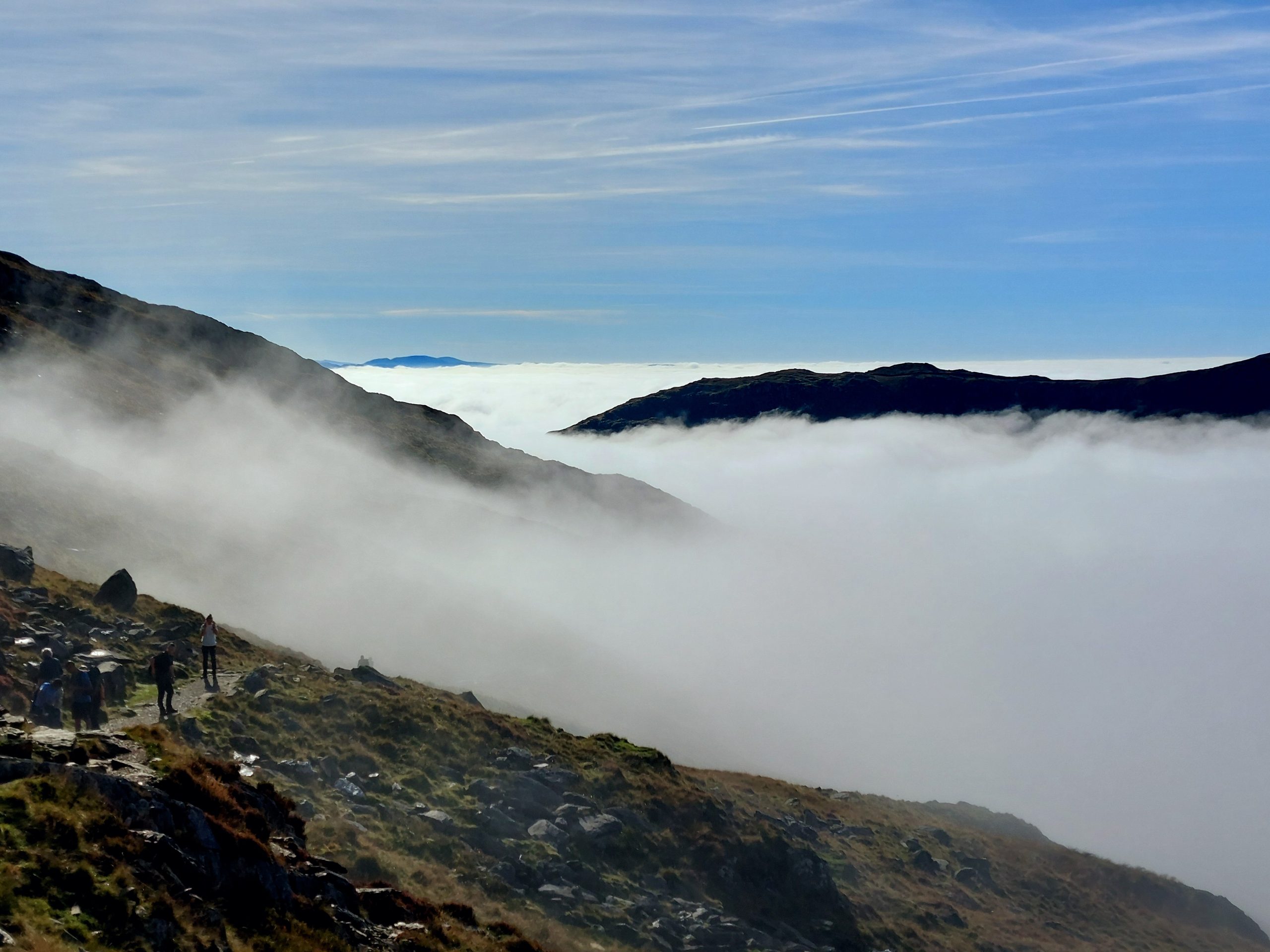
On this occasion those steeper sections which now lay ahead were particularly well hidden. From the outset we had been making our way through persistent, low lying cloud, giving the walk a characteristic damp autumnal feel. We marched up and up the side of Cwm Treglan, hoping the cloud would lift and reveal Snowdon in all its glory. But the cloud did not lift, it was sinking, and now lay spread before us, blanketing the valleys and leaving only the higher peaks and ridges standing proud. It was a rare cloud inversion, caused by a layer of warm air trapping the clouds beneath. We were fortunate to catch it, as the clouds had already started their retreat down the valleys and out to sea.
The inspiring views fuelled our remaining progress up the final few steep sections. The summit, as so often, was busy; a stark contrast to the more lonely summits we usually visit. After a break for lunch and a good gawp at the expansive views, we began our descent. Rather than return down the Watkin, we descended along the south ridge. A good path leads you over this dramatic and occasionally airy ridge. Neither the Watkin nor the south ridge are scrambles, but the Watkin does include one very short step which you need to clamber up, and the south ridge offers a similar experience at one point. Otherwise, the south ridge provides an easy walking descent over its roller-coaster profile.
At the bottom of the ridge, we turned back into the Cwm Llan. The clouds’ retreat was complete and as we ambled along the path we could enjoy clear views down and out beyond the valley. At one point we followed for a while the stone course of an old mining rail track. Further on it becomes an incline, but before that we dropped down to rejoin the Watkin Path, just above the Cwm Llan Waterfalls, to retrace our steps to Nant Gwynant.
A hard day’s walk but more than worth it for a spectacular day we will long remember.
Miles Thompson, Walk leader